Earth-observation satellites equipped with high-resolution Synthetic Aperture Radar (SAR) are currently orbiting the Earth, enabling continuous observation regardless of weather conditions or time of day.
Using an analysis technique known as Interferometric SAR (InSAR), we can extract ground deformation that occurred between two observation dates. The method measures small differences in the travel time of radar electromagnetic waves and convert them to displacements that occurred during the two acquisitions.
Through InSAR analysis, a wide range of surface movements can be detected in detail, including those caused by earthquakes, volcanic eruptions, land subsidence, landslides, and glacier flow. Today, InSAR has become an indispensable tool in Earth science research as well as in infrastructure monitoring.
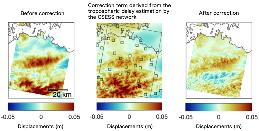
One of the primary noise sources in InSAR measurements is tropospheric signal delay. Although several correction approaches based on meteorological data have been developed and applied, more advanced techniques are required to capture ground motion with higher accuracy.
By utilizing GNSS observation data from CSESS, atmospheric propagation delays can be estimated at high spatial resolution, which can be used to significantly reduce the tropospheric noise in InSAR measurements.