Across the Japanese archipelago, crustal deformation is monitored daily with high precision by GEONET, a nationwide GNSS observation network comprising approximately 1,300 stations operated by the Geospatial Information Authority of Japan. GEONET is among the densest GNSS networks in the world and has played a central role in advancing our understanding of tectonic processes in Japan.
However, earthquakes of various magnitudes occur throughout the region, and deformation associated with shallow crustal earthquakes and fault activity, so-called inland earthquakes, often occurs over relatively limited spatial areas. Because the spacing of GEONET stations is approximately 20 km, it has been difficult to fully resolve such localized deformation signals.
The integration of data from the approximately 3,300 SoftBank original reference sites deployed across Japan provides a major opportunity to overcome this limitation. By combining these observations with GEONET data, crustal deformation fields can be resolved with much finer spatial detail. This enhanced resolution is expected to significantly improve our understanding of deformation processes associated with shallow crustal activity.
In fact, integrated analyses using data from the SoftBank network together with GNSS observations from the Geospatial Information Authority of Japan and universities have already revealed various types of transient crustal deformation. These include deformation associated with inland earthquakes as well as non-seismic processes such as subsurface fluid migration and slow slip events.
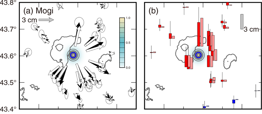
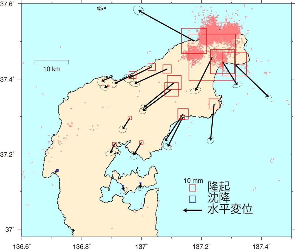
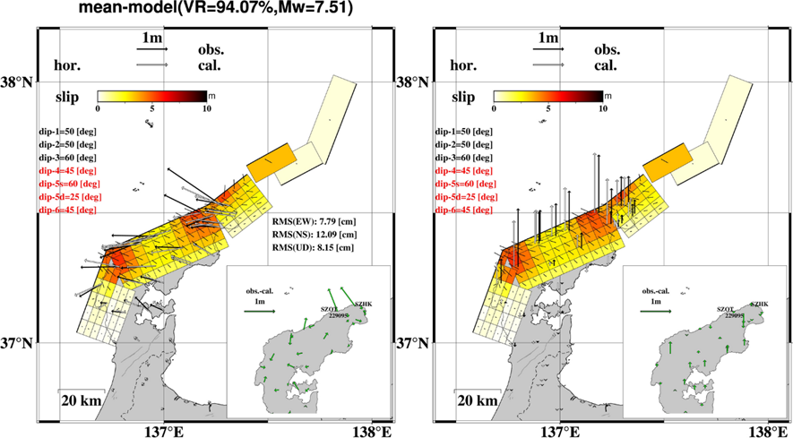
For example, between 2021 and 2023, transient crustal deformation indicative of subsurface inflation was detected near the Kussharo Caldera in eastern Hokkaido (Fig. 1; Ohzono et al., EPS, 2025). The dataset has also contributed to detailed analyses of the 2024 Noto Peninsula earthquake (M7.6), including the estimation of the coseismic slip distribution (Fig. 3; Yamada et al., 2025), characterization of postseismic deformation (Ohtate et al., 2025), and investigation of transient deformation processes that had been developing since 2020 (Fig. 2; Nishimura et al., 2023).
References:
Nishimura T., Y. Hiramatsu, Y. Ohta, Episodic transient deformation in the Noto Peninsula, central Japan, revealed by the analysis of multiple GNSS networks, Scientific Reports 13, http://doi.org/10.1038/s41598-023-35459-z, 2023.
Ohtate M., Y. Ohta, Y. Mitsui, Significant afterslip contribution to postseismic deformation on Sado Island following the 2024 Noto Peninsula Earthquake: Insights from two dense GNSS observation networks, Earth Planets Space, 77, 74, https://doi.org/10.1186/s40623-025-02203-y, 2025.
Ohzono M., H. Takahashi, Y. Ohta, K. Ohno, Transient inflation event at Kussharo caldera, eastern Hokkaido, Japan in 2021–2023 captured by multiple GNSS observation networks. Earth Planets Space 77, 41, https://doi.org/10.1186/s40623-025-02173-1, 2025.
Yamada T., Ohta Y., Nishimura T., Yoshida K., Hiramatsu Y., Kinoshita Y., Coseismic slip distribution of the 2024 Noto Peninsula earthquake deduced from dense global navigation satellite system network and interferometric synthetic aperture radar data: effect of assumed dip angle. Earth Planets Space 77, 19 (2025). https://doi.org/10.1186/s40623-025-02154-4, 2025.